Companies
- RIEGL Laser Measurement Systems: www.riegl.com
Mobile Geophysical Technologies (MGT): www.mgt-geo.com
weControl: www.wecontrol.ch
EMCOTEC embedded controller technologies: www.emcotec.de
Volz-Servos GmbH: www.volz-servos.com
Research Groups and Organizations
Swiss Federal Institute of Technology (ETH Zurich): www.ethz.ch
Measurement and Control Laboratory (ETH Zurich): www.imrt.ethz.ch
Autonomous Systems Lab (ETH Zurich): www.asl.ethz.ch
Institute of Geodesy and Photogrammetry (ETH Zurich): www.igp.ethz.ch
Lucerne University of Applied Sciences and Arts: http://www.hslu.ch/technik-architektur
UVS International: www.uvs-international.org
AUVSI: www.auvsi.org
AIAA: www.aiaa.org
Aeroscout GmbH
Aeroscout GmbH is located in Lucerne-Horw, Switzerland. Our primarily flight base is close to Lucerne, Switzerland, approx. 1h from the Zurich International Airport. The company was founded in 2005 and is a spin-off company of the Swiss Federal Institute of Technology (ETH) Zurich and was spun off from the Institute of Dynamic Systems and Control (formerly Measurement and Control Laboratory). The company is headed by Dr. Christoph Eck (CEO), a former doctoral and post-doctoral student of ETH Zurich and a former managing partner at weControl AG.
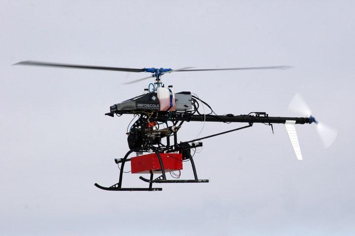
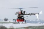
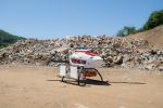
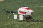
Aeroscout is interested in promoting reliable and industrial UAV technologies for civil, paramilitary, scientific, and humanitarian applications. The Aeroscout team has been working on UAVs since 1995. The Aeroscout portfolio includes high-resolution aerial imagery, e.g. for photogrammetry and 3D aerial modeling, industrial plant inspection and photography, commercial videos and photographs, as well as scientific applications.
Aeroscout develops its own unmanned industrial helicopters and integrates state-of-the-art UAV components. Our UAV systems are continuously tested on the flight base and new helicopter systems keep being developed. Aeroscout provides a strong network of international partners, and Aeroscout products are internationally available. Aeroscout is registered at the Swiss Export Commission (SECO) for international export.
Aeroscout trusts our present and future customers will highly benefit from our competitive UAV developments, products, and services worldwide. Clients may expect UAVs customized by Aeroscout to surpass existing UAV solutions. Our UAV helicopters are also regularly inspected and controlled by the Swiss Aviation Authority (BAZL).
If it's airborne, it's Aeroscout.
Aeroscout is your partner for unmanned aircraft technology.
If you don't find your question below, please contact Aeroscout.
- What does "UAV" mean?
- How far can I fly?
- How long can I fly?
- How fast can I fly?
- Do I need flight insurance?
- Do I need to fly manually?
- Which data link can I use?
- What happens if my data link fails?
- What happens if my GCS fails?
- How do I prepare a UAV flight mission?
- How can I make a flight reservation?
What does "UAV" mean?
UAV is the abbreviation for unmanned (sometimes also called uninhabited) aerial vehicle. Unmanned aerial vehicles include fixed wing aircraft, rotary wing aircraft, and lighter-than-air aircraft. In general UAVs can be very small, i.e. a few centimeters, or very large, i.e. almost hundred meters. Aeroscout specializes in unmanned industrial helicopters.
How far can I fly?
The flight distance depends on technology, operation, and regulation. Technology defines the type of data communication, e.g. the frequency, the radiated power, and the resulting range of the data link when operating the UAV. When flying in manual mode, line-of-sight between the pilot and the helicopter is required. Manual flights are normally a few hundreds of meters while autonomous flights of Aeroscout UAVs are up to a few kilometers. Regulations vary for all countries, e.g. some countries require line-of-sight conditions while others don't. Often, different regulations apply depending on the application.
How long can I fly?
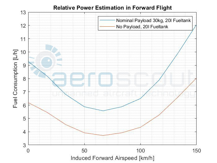
The resulting flight time is defined by the amount of onboard fuel, the specific fuel consumption of the aircraft/engine (liters per PS per hour), the flight velocity, the flight altitude, and the environmental conditions. Typical flight times for Aeroscout UAVs are 30 minutes up to 3 hours.
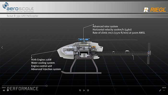
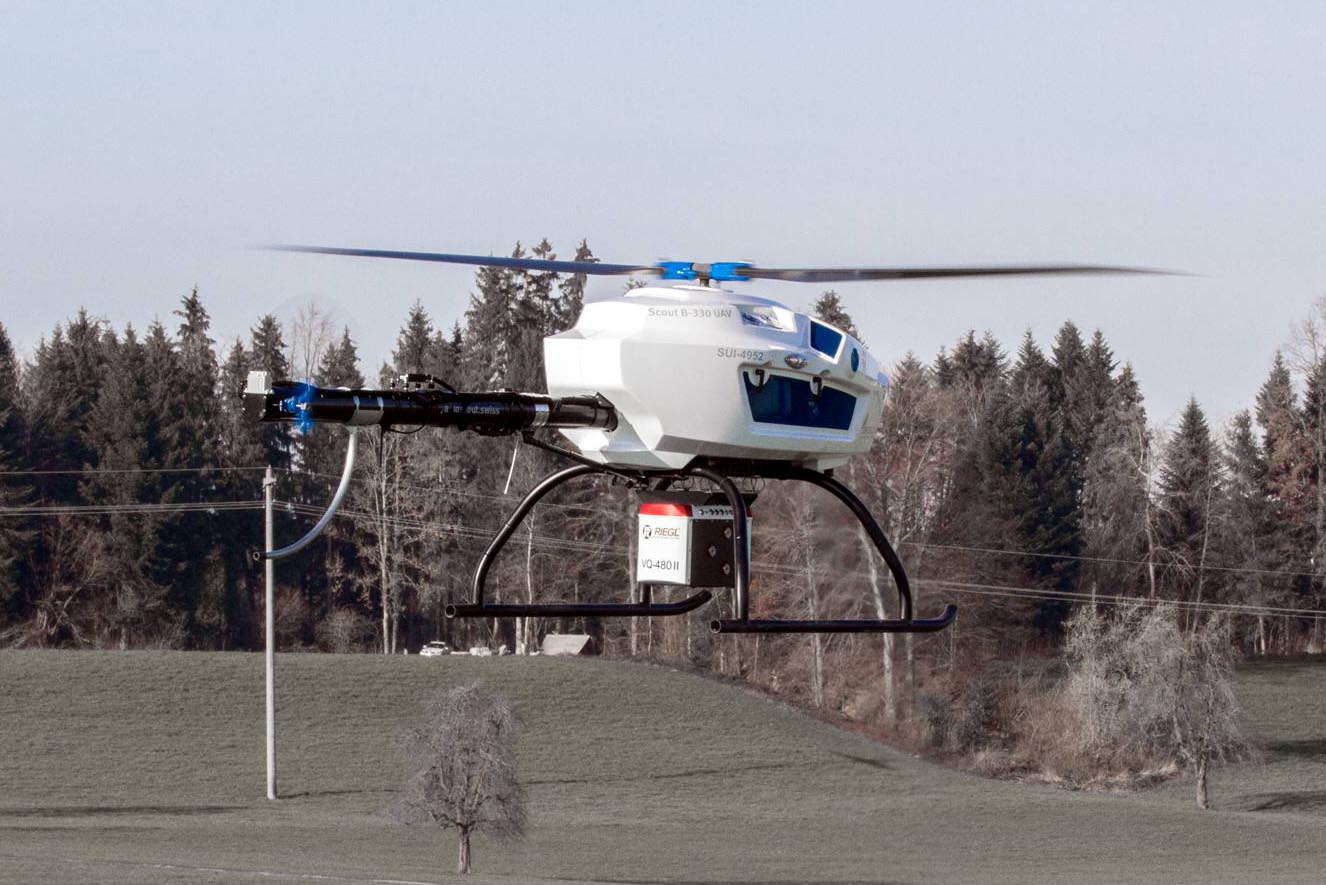
The Scout B-330 integrates a 20L standard fuel tank. A as rule of thumb, the following can be taken to calculate the flight time.
Flight time with 20L tank 30kg Payload:
Hover: 2h15min
Cruise at 50km/h: 3h15min
Cruise at 120km/h: 2h30min
Flight time with 20L tank without Payload:
Hover: 3h15min
Cruise at 50km/h: 4h
Cruise at 120km/h: 3h30min
How fast can I fly?
The maximum flight velocity is given by the onboard flight control system and varies for different sizes of the Aeroscout helicopters. A UAV such as the Scout helicopters typically flies at 40-60 km/h. If necessary, higher velocities can be activated on the flight control system.
Do I need flight insurance?
Yes. When operating the UAV, in manual or in autonomous mode, most countries require aircraft liability insurance. Service flights by Aeroscout are insured by Aeroscout.
Do I need to fly manually?
No, not necessarily. When operating the UAV in completely autonomous mode with the ground control station (GCS) all flight stabilization - including take-off and landing - is done by the onboard flight control system. Aeroscout recommends at least a few hours of manual flight training (or simulator training) in order to understand the basic physical principles of helicopters. Please refer also to our Services and Training section.
Which data link can I use?
There are many different data links available with different frequencies, antennas, and radiation power. Each country has its own regulation for the usage of wireless data links. The data links used on the Aeroscout UAVs are modems with a standard RS-232 serial interface and a transmission rate of at least 9600 Baud (semi-duplex mode).
What happens if my data link fails?
When the Aeroscout UAV is in mission mode, a data link failure causes the UAV to interrupt its mission and go to hover flight. After a certain time period without re-establishment of the data link, the UAV automatically switches to homing mode. The home location is always predefined by the mission. In case of continued loss of data communication, the Aeroscout UAV is programmed to proceed to automatic landing and to shut down the engine.
What happens if my GCS fails?
If the GCS fails, e.g. due to loss of power, the Aeroscout UAV is programmed to switch to the same procedure as described for a data link failure.
How do I prepare a UAV flight mission?
Before operating the Aeroscout UAV, Aeroscout provides the education and training on mission planning and monitoring the UAV during its mission. This training includes the understanding of the weGCS ground control station software. The same software can also be used for hardware-in-the- loop simulation. A mission consists of predefined GPS waypoints, given be latitude, longitude, altitude, flight velocity, and the homing waypoint.
How can I make a flight reservation?
Aeroscout will first discuss and plan the requested mission with the client. Aeroscout furnishes an offer in writing, which includes the time schedule, the flight crew, the UAV system, and the payload defined by the client. Based on the Aeroscout quote, a final flight reservation can be made by the client.
Publisher
Aeroscout GmbHHengstrain 14
6280 Hochdorf
Switzerland
This email address is being protected from spambots. You need JavaScript enabled to view it.